Map Source:
Our maps were created using the Department of Transportation (DOT)
Pipeline and Hazardous Materials Safety Administration PHMSA public map
viewer than taking screen shots to post them
here. Before
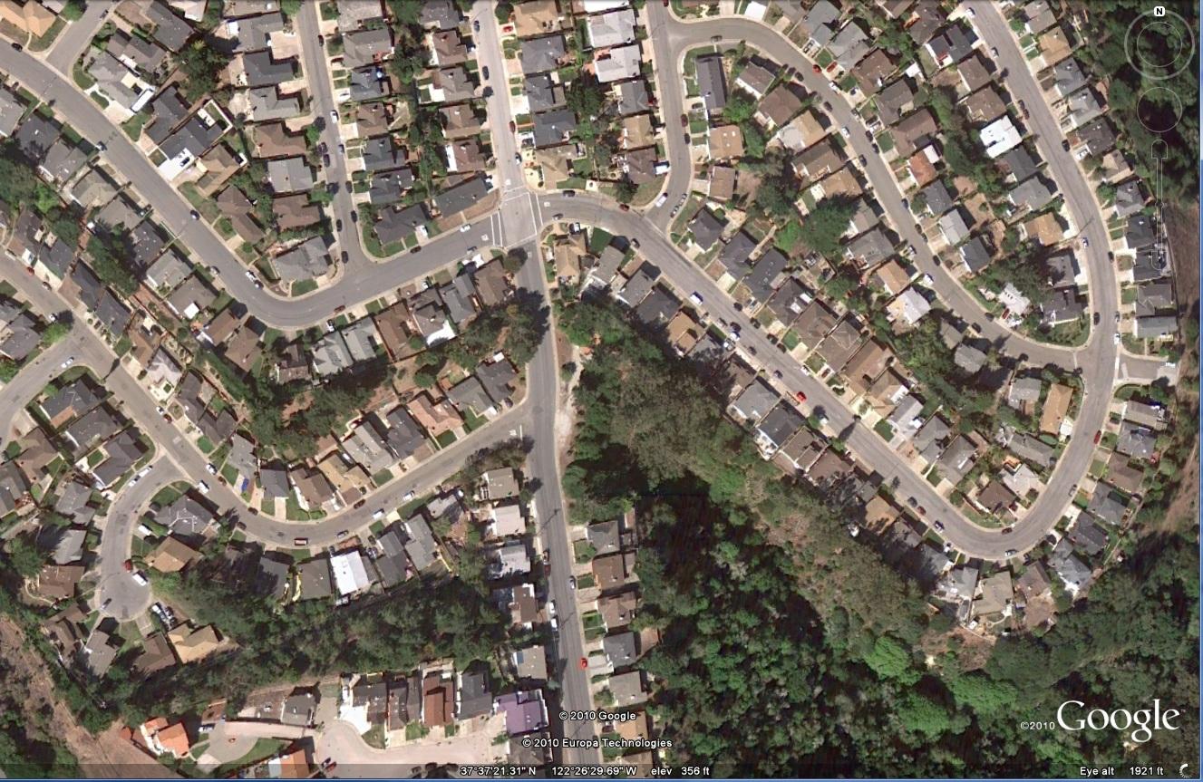
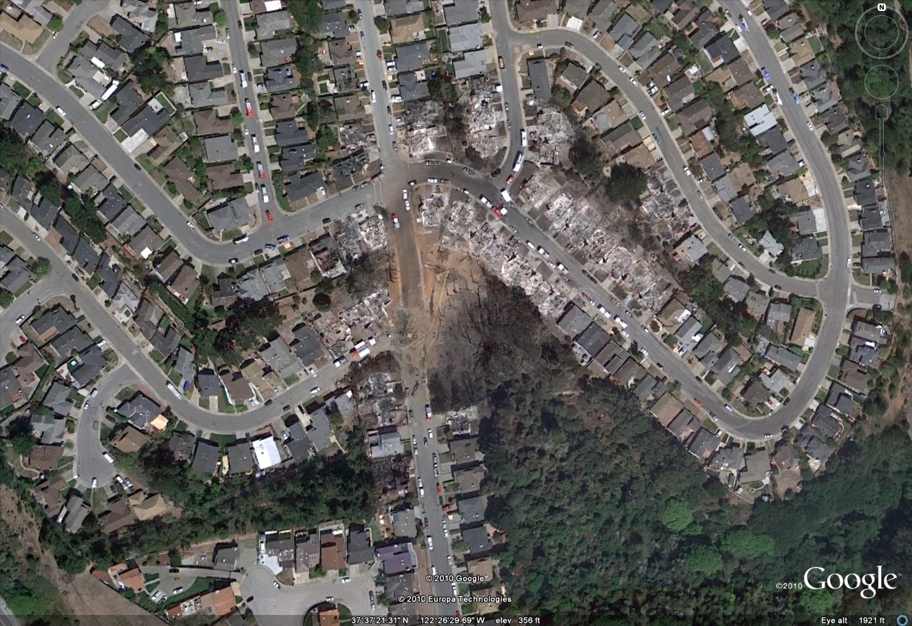
and After Photos
On September 9, 2010 a 30-inch diameter
natural gas
transmission pipeline (Line 132) owned and operated by Pacific Gas
& Electric Company (PG&E) ruptured in a residential area in San
Bruno, California. The fire killed 8 people, destroyed 37 homes
and damaged another 18 homes in the blast vicinity. Excerpts from
the National Transportation
Safety
Board's "Preliminary Report" says:
The rupture on Line 132 occurred near mile
post (MP) 39.33, at the intersection of Earl Avenue and Glenview Drive
in the city of San Bruno. Approximately 47.6 million standard cubic
feet (MMSCF) of natural gas was released as a result of the rupture.
The rupture created a crater approximately 72 feet long by 26 feet
wide. A pipe segment approximately 28 feet long was found about 100
feet away from the crater. The released natural gas was ignited
sometime after the rupture; the resulting fire destroyed 37 homes and
damaged 18. Eight people were killed, numerous individuals were
injured, and many more were evacuated from the area.
We would not want to own a home within the blast zone at
any price and
would try to avoid homes close to the pipeline that are at risk of
destruction from a fire.
Natural Gas Pipeline Maps for
|
 Home: ForBestAdvice
- Real
Estate - Natural Gas Pipeline Maps
==> Best
Mortgage Rates <==
Home: ForBestAdvice
- Real
Estate - Natural Gas Pipeline Maps
==> Best
Mortgage Rates <==